Onboard Data Control and Navigation System for Airborne Geophysical Surveys NAVDAT
NAVDAT is an integrated onboard computing system. It consists of hardware and software components:
Onboard computer (IBM/PC, Debian GNU/LINUX operating system)
Set of additional indicators for a pilot
Software
NAVDAT executes following operations:
Data Registration
Due to the original system structure NAVDAT register data from all onboard sources of digital information nearly without restrictions on the speed of data acquisition. And for interaction any standard computer interfaces can be used.
Data Control
NAVDAT controls not only acquisition of data, but also automatically analyses structure and quality of received geophysical information and automatically controls functioning of geophysical equipment.
Data Recording
DATA are recorded continuously and actions of an operator or a pilot cannot affect the process. Data integrity is guaranteed.
Visualisation Of Received Information
All received information is displayed on the computer screen in real time in a way convenient for the operator.
NAVDAT flexible structure provides the opportunity to update it promptly and to add support of new devices manufactured not only by Geotechnologies, but also by other manufacturers. Today NAVDAT supports more than 20 devices.

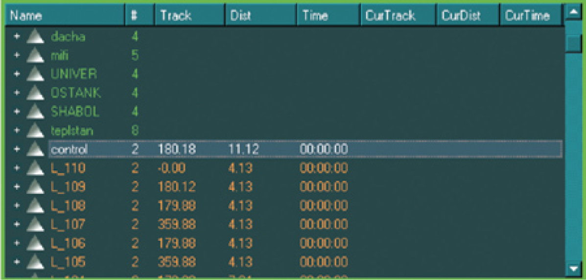
List and charts of measured parameters
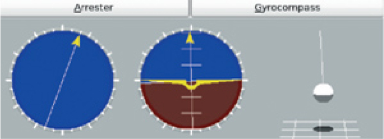
Gyro system indicator

Indicator of onboard equipment status

Gamma-ray spectrometer window
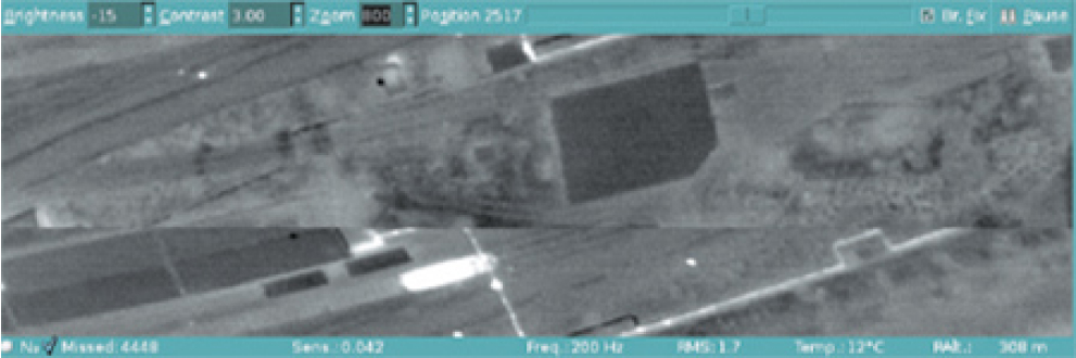
Infrared scanner window

GPS-receiver window
Preflight Preparations
During preparation it is necessary to set only few parameters: allowed values of lateral and vertical deviation, some dynamic characteristics of the aircraft, and to prepare flight plan in a form of the text file, which consist of list of the routes and geographical coordinates of the points of these routes. This can be done in Geosoft Oasis Montaj or by the special procedure of NAVDAT software. To train a pilot to interact with NAVDAT indicators there is a mode of flight emulation. This mode also can be used to adjust parameters of flight control algorithm according to the pilot recommendations and to exercise his piloting style before real flights.
Flight Control And Information Support Of A Pilot
NAVDAT software automatically provides navigation solutions in real time. Results of calculations are displayed on special indicators as guidance instructions which allow the pilot to fly precisely and not to waste flight time. The program uses control algorithms, which ensure compliance with the strictest requirements to navigation quality.
The structure of information exchange in NAVDAT is organized in a way that interaction with a pilot can be adjusted to make unnecessary presence of an operator on board during a survey flight. In this case a pilot additionally receives only minimum necessary messages to make decisions.
Flight plan panel

Flight panorama for a pilot
During a survey NAVDAT allows the pilot to orientate easily in the area not distracting him from flying the aircraft and not overwhelming him with unnecessary visual information. The system suggests to the pilot the best trajectory for turning from one route to another, helps him to enter the route with minimum lateral and course deviations.

As a pilot's indicator standard tablet/smartphone (Android OS) or portable TV can be used.

Pilot's indicator in the turning mode

Pilot's indicator in the route following mode
Navigation Quality
The same very experienced pilot, the same helicopter (Eurocopter AS350B3), the same relief and the weather. Route distance is 200 meters.

Paths of the flight, in which the first mode of NAVDAT was used, standard deviation is 6 meters.

Paths of the flight, in which the second mode of NAVDAT was used, standard deviation is 2 meters.
During a survey flight NAVDAT can work in one of two operation modes. In the first mode the system shows to a pilot current value of lateral deviation from the given trajectory. This mode is familiar to many pilots who have an experience of aerogeophysical surveys. In the second mode pilot's instructions are based on the forecast that is calculated with account of current parameter of the flight: linear and angular speed and course. Using this mode even an inexperienced pilot is able to perform the survey with necessary navigation accuracy.